Atelier recherche ''Imagerie radar et cryosphère'' à l'école d'ingénieurs
Le laboratoire de recherche LISTIC organise un atelier ''Imagerie radar et cryosphère'' le 11 juin à Polytech, sur le site d'Annecy. L'évènement propose dix présentations sur la technologie SAR (Synthetic Aperture Radar) et son application à l'observation de la neige et des glaciers, animées par des chercheurs des universités Savoie Mont Blanc, Grenoble et Rennes, et de l'Indian Institute of Technology (IIT) de Bombay.
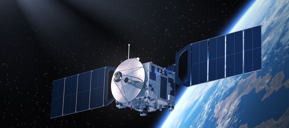
 « L'imagerie radar à synthèse d'ouverture (Synthetic Aperture Radar - SAR) permet d'observer la Terre et plus particulièrement l'évolution de la cryosphère (l'eau à l'état solide) depuis l'espace, notamment par les satellites ''Sentinel-1'' développés par l'agence spatiale européenne. Les applications sont multiples, comme par exemple le suivi du manteau neigeux et des avalanches par Météo France, ou encore l'observation des conséquences du changement climatique et la fonte des glaciers de l'Himalaya, véritable chateau d'eau sur le toit du monde. » explique Emmanuel Trouvé, directeur du LISTIC et enseignant-chercheur à Polytech Annecy-Chambéry.
« La technologie SAR permet d'obtenir des images de jour comme de nuit et quelle que soit la météo » précise Avik Bhattacharya, professeur associé à l'IIT Bombay. Invité par l'Université Savoie Mont Blanc, Avik Bhattacharya ouvrira l'atelier avec un exposé intitulé ''Novel techniques for snow cover mapping using polarimetric SAR images''.
Au programme du workshop
- 9h30 Novel techniques for snow cover mapping using polarimetric SAR images
Avik Bhattacharya, Arnab Muhuri, Surendar Manickam; Microwave remote sensing lab (MRSLab), Center of studies in resources engineering, Indian Institute of Technology Bombay
- 10h00 Monitoring wet snow over an alpine region using Sentinel-1 observations
 Fatima Karbou, Gaelle Veyssière, Cécile Coleou, Anne Dufour, Isabelle Gouttevin, Simon Gascoin et
Manuel Grizonnet, CNRM UMR 3589, Météo-France/CNRS
- 10h30 Wavelet temporal analysis of PolSAR decomposition parameters over glacier area
Davide Pirrone, Abdourrahmane Atto, Emmanuel Trouvé, LISTIC, Université Savoie Mont Blanc
- 11h30 Characterization of the internal structure snow and ice packs using 3-D SAR imaging at various scales
Laurent Ferro-Famil, IETR, University of Rennes, France and Stefano Tebaldini, Politecnico di Milano, DEIB, Italy
- 12h00 Spaceborne SAR data processing for snow and ice monitoring
Michel Gay, Gabriel Vasile, GIPSA-lab, CNRS-INP Grenoble
- 12h30 Robust change detection
Guillaume Ginolhac, LISTIC, Université Savoie Mont Blanc
- 14h00 Examples of remote sensing applications for the study of glaciers and ice sheets
Antoine Rabatel, Jéremy Mouginot, IGE Grenoble, Etienne Berthier, LEGOS Toulouse, Amaury Dehecq, Caltech, USA
- 14h30 Spatio-temporal evaluation of rock glacier activity in the semi-arid Andes using optical and radar satellite imagery
Xavier Bodin, EDYTEM, CNRS Université Savoie Mont Blanc
- 15h00 Multi-temporal and multi-sensor quantification of surface flow velocity of mountain glaciers to understand changes in glaciers dynamics and improve glacier thickness estimates
Romain Millan, IGE Grenoble, France
- 15h30 A gap-filling method to reconstruct incomplete SAR displacement measurement time series
Alexandre Hippert-Ferrer, Yajing Yan, Philippe Bolon, LISTIC, Université Savoie Mont Blanc
- 16h00 Perspectives: test-sites, data sets, projects
")